 University of Campinas
  Geosciences Institute
Save the date / Call for papers
A revista Terræ publica simultaneamente as edições online de 2016 e 2017. As edições impressas acham-se temporariamente suspensas, pois os editores reconhecem que a internet oferece formas mais eficazes para disseminar rapidamente os resultados das pesquisas. As reformulações do periódico objetivam ampliar a abrangência, combinando redução de custos com rapidez de publicação. Cada vez mais a revista consolida a tendência de cobrir temas multidisciplinares que revelem formas de interação das Geociências com as diferentes áreas do conhecimento humano. A edição de Terræ 2017 é inteiramente dedicada ao tema GEOPARQUES.
A revista aceita trabalhos e comunicações em Português, Inglês e Espanhol.
Chamada de trabalhos / CALL FOR PAPERS
Uma vez recuperado o tempo de ausência na web, a edição de Terræ 2018 tornar-se-á uma boa opção para publicação de artigos científicos. O volume deverá reunir contribuições referentes a GEOÉTICA, tema que permite acomodar abordagens diferenciadas que revelem as inter-relações entre a sociedade e os ecossistemas terrestres.
O sistema de submissão e avaliação de artigos científicos está em pleno funcionamento, sendo feito exclusivamente pelo E-mail: terrae@ige.unicamp.br. Nosso sítio web está à sua disposição.
Esperamos sua visita e participação!
Os editores.
10/01/2018- 16:31 pm
Chamada de trabalhos/ Call for papers para o Volume 15, 2018
Novas contribuições são aceitas para o volume 2018 de Terræ.
Data limite 30.abril.2018
10/01/2018- 16:31 pm
Chamada de trabalhos/ Call for papers para os eventos:
VIII GeoSciEd 2018 – the 8th Quadrennial Conference of the
International Geoscience Education Organisation (IGEO)
– Geosciences for Everyone –
VIII Simpósio Nacional de Ensino e História de
Ciências da Terra / EnsinoGEO-2018
– Geociências para Todos –
Campinas – Sao Paulo – Brazil, July 2018
Acesse o site: http://www.ige.unicamp.br/geoscied2018/en/.
Data limite 11.fevereiro.2018
11/01/2018- 13:40 pm
Livro "Geologia do Brasil”, 2012: Reserve já seu exemplar, sem despesas de remessa.
Visite o endereço eletrônico: www.editorabeca.com.br
Os editores
Campinas, janeiro de 2018.
Geochemical atlas of the Eastern Barents region

Jörg Matschullat
Technische Universität Bergakademie Freiberg
When, in 1998, Reimann et al. published the "Environmental Geochemical Atlas of the Central Barents Region" (Kola peninsula), I was delighted to see a consequent realization of the giant task of mapping substantial areas with stringent quality control and very professional scientific data interpretation over an area of 188,000 km2 (review in Environ. Geol., 35, 4:290-291). That project led to another very ambitious and successful one, the "Baltic Soil Survey". It was published by Reimann et al. (2003) as the "Geochemical Atlas on Agricultural Soils in Northern Europe" (Geol Jb D, SD5: 279 p. with CD-ROM; review in Journal of Soils and Sediments 2003; 3(4): 292). Six years later, the Kola-project received a second large sibling, the "Geochemical Atlas of the Eastern Barents Region", covering most of Finland and all of the northern parts of Russia east to the Ural mountains – an area of 1.55 million km2 – that follows the previous experience of Reimann et al. (1998, 2003) in its principal layout and ideas. The benefit of that "Kola" atlas has been so convincing that despite several problems along the way, this new project was launched in 1999 by a large team of Finnish and Russian colleagues, and a renowned publisher has taken on the responsibility of producing and marketing the product.
The primary aim of the new atlas was to establish a geochemical baseline for that part of the Nordic environment since the area is expected to see major changes, industrial and resource development, and settlement in the near future. A total of 288 sites in Finland and 1085 sites in Russia have been sampled (terrestrial mosses, organic topsoil, C-horizon, and stream water) in the years 2000 and 2001. The sampling density of 1 per 1,000 km2 is additionally backed by 30 special sites with high density sampling and the inclusion of additional tasks, e.g., the investigation of vegetation (shrubs and trees) and precipitation. Most materials have undergone both full digestion and selective extraction, and all samples and analytical procedures (by the reputable laboratory of Heiki Niskavaara, Finnish Geological Survey) have undergone a very well documented and thorough quality control procedure. More than 50 elements including radionuclides and additional parameters (e.g., pH-values, alkalinity, LOI etc.) have been analyzed and the full-color maps display 48 parameters, often in several maps.
Followed by an introduction that vividly describes the project background and organization, a second chapter delivers the necessary understanding for the areas’ climate, vegetation and soil types, geophysical and geological information, metallogenic features and human activities with environmental status. This part is illustrated with thematic maps and other helpful figures and photographs. The third chapter is dedicated to the applied methods (sampling, sample preparation, analysis, and quality control), followed by chapter 4 on the chemical composition of atmospheric precipitation (measured throughout one full year). Chapter 5 makes up the most prominent part of the book, the element maps, statistics and interpretation (pages 59 to 522). Each element – from silver (Ag) to Zirconium (Zr) – is being introduced with a short table on its occurrence in different environments (lithosphere, rock types, soil, stream water, sea water, and the biosphere), followed by a description on the data obtained from this project. The subsequent pages provide tables and an extensive series of box and whisker plots, and a series of full-color maps (Kriging with point information) and frequency diagrams for the data.
The sixth chapter gives general data interpretation, taking into account geographical zoning (climate, anthropogenic and geogenic factors, including sea spray), geogenic anomalies differentiated by lithology and mineralizations, anthropogenic anomalies, and some physical reasons for unusual element behavior. This part is rounded up by conclusions, acknowledgements, and the reference list. The final pages are dedicated to an appendix that contains an extensive table with all data in alphabetical order.
Apart from the successful demonstration and registration of the desired baseline values, the effort is rewarded by invaluable information on natural resources and a wealth of information for further scientific evaluation and interpretation. The data will become part of the Pan-European database that in itself is a contribution to the Global Geochemical Baseline Program within IUGS/IAGC. One of the more thought-provoking results is the fact that no evidence could be found for a substantial atmospheric long-range transport of trace elements in that area. This was already suggested by Reimann et al. (1997 in Atmos. Environ. 31(23) : 3887-3901) in one of the many publications from the Kola project, and is being substantiated further and over a much larger region. Finally, some shortcomings should be mentioned that may be considered if a second edition is ever possible – or may be incorporated into future similar efforts like the Brazilian PGAGEM project, a nationwide geochemical mapping program that is now underway.
My prime criticism is related to the print quality, particularly in respect to print size of fonts in tables, and many figures and their legends. Without a magnifying glass, many axis descriptions are illegible to me. It seems obvious that this was done to save space, but I would suggest that it would have been better to reproduce fewer figures but make them nicer – and to add a CD-ROM to the book with additional material, and all of the data and maps (which would have been a great idea anyway). Another point relates to the element distribution maps: they lack a grid that would help to identify locations more easily. This grid was not present in the previous atlases either, but since the area is now a lot bigger, this information seems more relevant. In addition, it would have been advantageous to make the (almost) full-page maps even bigger (i.e., bigger book format). And maps like pH scale should display the color code in the standard form, since everyone connects red color with acid conditions and blue or green colors with more neutral and basic conditions. Compared to the overall achievement, this criticism seems somewhat petty, but while it does not question the value of the work, it may contribute to further improve related efforts. We can also look forward to a plethora of publications that must now follow to interpret and evaluate the obtained data in a much more detailed fashion.
The fact that Elsevier is taking care of this work will hopefully lead to a wider distribution and awareness of this beautiful achievement and at the same time direct more attention to previous related works. Forthcoming projects will be delighted to see and learn that it is both possible and feasible to make such projects a reality with even a relatively small budget (the whole Eastern Barents mapping program cost less than 4 million Euro).
This contribution is a modified version of a review to appear in a forthcoming issue of Environmental Geology (Springer).
Volume 14, 1-2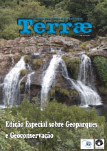
Volume 13, 1-2
Volume 12, 1-2
Volume 11, 1-2
Volume 10, 1-2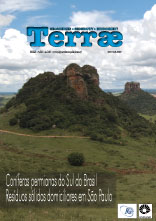
Volume 9, 1-2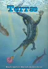
Volume 8, 1-2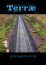
Volume 7, 1-2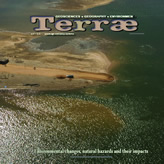
Volume 6, 1-2
Volume 3,4,5
Volume 2
Volume 1
A PDF reader is required to view the article files. Make the download here: Adobe Acrobat or Foxi